
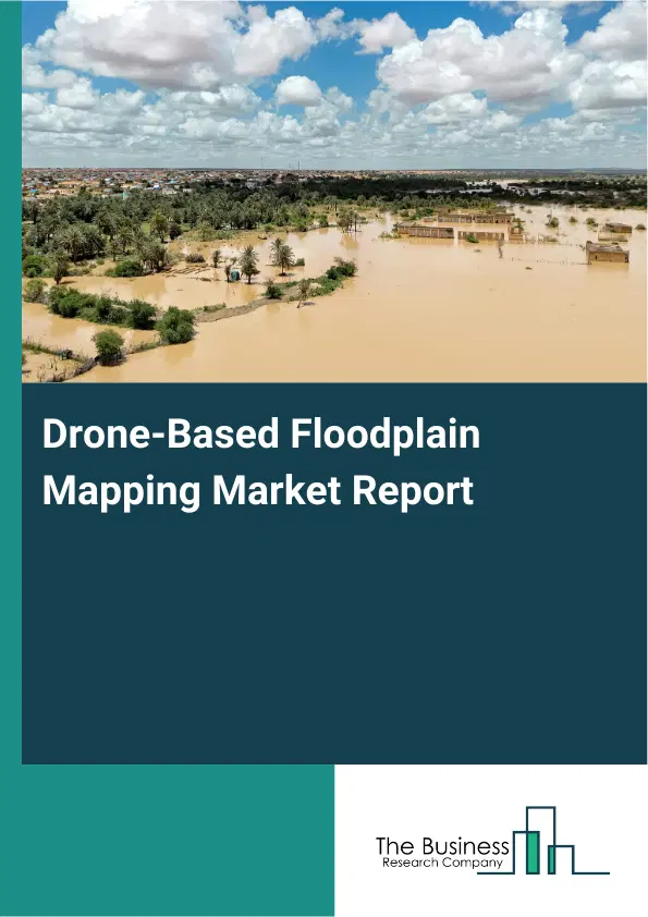
Drone-Based Floodplain Mapping Market Report 2026
Global Outlook – By Solution (Hardware, Software, Services), By Platform (Fixed-Wing Drones, Rotary-Wing Drones, Hybrid Drones), By Application (Flood Risk Assessment, Disaster Management, Urban Planning, Environmental Monitoring, Other Applications), By End-User (Government And Public Safety, Agriculture, Insurance, Construction, Other End-Users) – Market Size, Trends, Strategies, and Forecast to 2030
Drone-Based Floodplain Mapping Market Overview
• Drone-Based Floodplain Mapping market size has reached to $1.58 billion in 2025 • Expected to grow to $4.38 billion in 2030 at a compound annual growth rate (CAGR) of 22.6% • Growth Driver: Increasing Frequency Of Flood Events Fueling The Growth Of The Market Due To Climate Change–Driven Rainfall And Rising Flood Risks • Market Trend: Advanced LiDAR Drones Boost Survey Efficiency • North America was the largest region in 2025 and Asia-Pacific is the fastest growing region.What Is Covered Under Drone-Based Floodplain Mapping Market?
Drone-based floodplain mapping is the use of unmanned aerial vehicles (drones) equipped with sensors and cameras to capture high-resolution aerial data of riverine and flood-prone areas. It is used to accurately map floodplains, assess risk zones, and support flood management, planning, and mitigation efforts. This method offers faster, safer, and more detailed data compared to traditional surveying techniques. The main solutions of drone-based floodplain mapping are hardware, software, and services. Hardware is the physical components of a computer or electronic system, such as the processor, memory, storage devices, and peripheral equipment, that enable it to function. It utilizes different platforms such as fixed-wing drones, rotary-wing drones, and hybrid drones, and finds application in flood risk assessment, disaster management, urban planning, environmental monitoring, and others, serving end-users such as government and public safety, agriculture, insurance, construction, and others.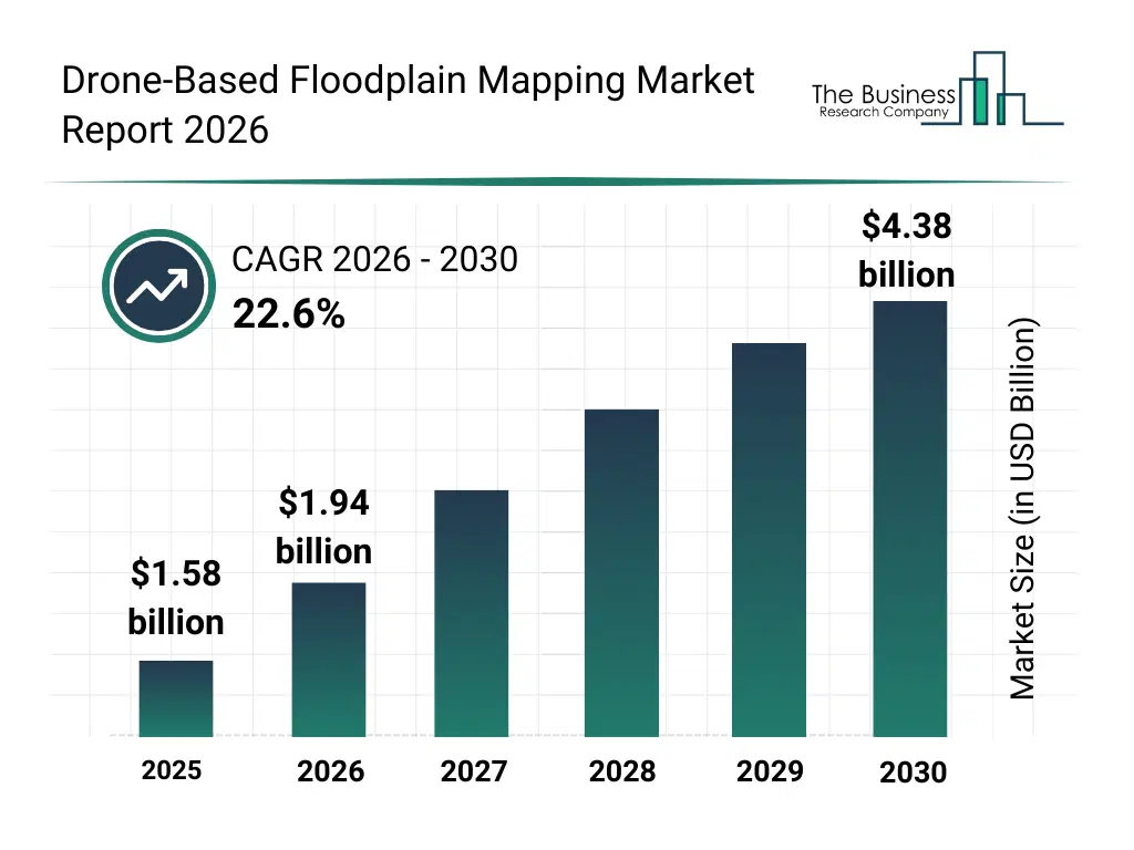
What Is The Drone-Based Floodplain Mapping Market Size and Share 2026?
The drone-based floodplain mapping market size has grown exponentially in recent years. It will grow from $1.58 billion in 2025 to $1.94 billion in 2026 at a compound annual growth rate (CAGR) of 22.8%. The growth in the historic period can be attributed to increasing frequency of flood events, reliance on manual surveying techniques, rising need for accurate hazard mapping, growing adoption of drone imaging tools, limited accessibility of high-risk regions.What Is The Drone-Based Floodplain Mapping Market Growth Forecast?
The drone-based floodplain mapping market size is expected to see exponential growth in the next few years. It will grow to $4.38 billion in 2030 at a compound annual growth rate (CAGR) of 22.6%. The growth in the forecast period can be attributed to expansion of predictive flood modeling, increasing investment in climate resilience projects, rising deployment of lidar-equipped drones, growing government focus on disaster risk reduction, increasing integration of real-time aerial data platforms. Major trends in the forecast period include rising demand for high-resolution floodplain mapping, increased use of drone-based hazard zone identification, growing adoption of rapid aerial flood assessment, expansion of drone-supported urban planning and infrastructure mapping, improving accuracy in environmental monitoring through aerial imaging.
Global Drone-Based Floodplain Mapping Market Segmentation
1) By Solution: Hardware, Software, Services 2) By Platform: Fixed-Wing Drones, Rotary-Wing Drones, Hybrid Drones 3) By Application: Flood Risk Assessment, Disaster Management, Urban Planning, Environmental Monitoring, Other Applications 4) By End-User: Government And Public Safety, Agriculture, Insurance, Construction, Other End-Users Subsegments: 1) By Hardware: Unmanned Aerial Vehicles, Light Detection And Ranging Systems (LiDAR Systems), Multispectral Or Hyperspectral Cameras, Global Navigation Satellite System Or Global Positioning System Equipment, Thermal Sensors, Drone Payloads 2) By Software: Geographic Information System (GIS) Software, 3D Photogrammetry Software, Data Processing And Analytics Platforms, Mapping And Visualization Tools, Predictive Modeling Software 3) By Services: Aerial Surveying Services, Data Collection And Processing Services, Risk Assessment And Analysis Services, Consulting And Advisory Services, Maintenance And Support ServicesWhat Is Driver Of The Drone-Based Floodplain Mapping Market?
The increasing frequency of flood events is expected to propel the growth of the drone-based floodplain mapping market going forward. Flood events refer to occurrences where water from rivers, lakes, oceans, or heavy rainfall overflows onto normally dry land, causing temporary or prolonged inundation. The rise in flood events is due to climate change, which intensifies rainfall and causes excessive water accumulation in rivers and low-lying areas, leading to more frequent flooding. Drone-based floodplain mapping helps address flood events by offering high-precision terrain and water flow data, making it ideal for identifying flood-prone areas. It reduces manual surveying effort by providing accurate 3D elevation models and real-time insights, improving flood risk assessment and mitigation planning. For instance, in December 2023, according to the UK Health Security Agency, a UK-based government agency, the number of people in the UK at risk of flooding is expected to grow by 61% by 2050 and further to 118% by 2080. Therefore, the increasing frequency of flood events is driving the growth of the drone-based floodplain mapping industry.Key Players In The Global Drone-Based Floodplain Mapping Market
Major companies operating in the drone-based floodplain mapping market are SZ DJI Technology Co. Ltd., Esri Inc., Topcon Positioning Systems Inc., Terra Drone Corporation, Autel Robotics Co. Ltd., Skydio Inc., Quantum-Systems GmbH, Parrot SA, Microdrones GmbH, Pix4D SA, Wingtra AG, Delair SAS, AgEagle Aerial Systems Inc., FlyGuys Inc., GreenValley International LLC, GeoCue Group Inc., Draganfly Inc., Darling Geomatics Inc., Inspired Flight Technologies Inc., IdeaForge Technology Pvt. Ltd.
This chart is for illustrative purposes; the full report includes a detailed competitor analysis and comprehensive overview of the top 10 companies in the market.
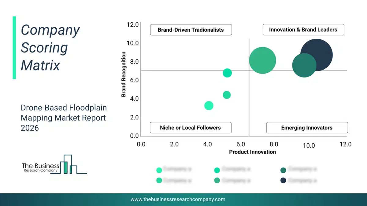
This chart maps companies by product innovation and brand strength, with bubble size indicating relative revenue, helping identify market leaders, challengers, and niche players. This is an illustrative chart; the full report provides a complete and accurate competitive analysis.
Global Drone-Based Floodplain Mapping Market Trends and Insights
Major companies operating in the drone-based floodplain mapping market are focusing on developing advanced products, such as integrated light detection and ranging (LiDAR) systems, to boost data accuracy, enhance survey efficiency, and reduce manual processing time and costs. Integrated light detection and ranging (LiDAR) systems refer to advanced sensor packages on drones that use laser light to measure exact distances to the Earth's surface, generating highly precise 3D elevation models of terrain, even under vegetation. For instance, in March 2024, Wingtra AG, a Switzerland-based vertical take-off and landing (VTOL) drone producer company, launched a new drone light detection and ranging (LiDAR) solution, integrating a Wingtra-engineered light detection and ranging (LiDAR) sensor with the WingtraOne Generation Two (GEN II) drone to deliver high-precision, efficient, and easy-to-use mapping capabilities. This all-in-one solution reduces field time, minimizes post-processing, and provides consistent, top-quality three-dimensional (3D) point cloud data even in challenging terrains. Its unique features include one-minute initialization, automated flight patterns, and minimal noise capture, ensuring reliable and repeatable results across varied survey conditions.What Are Latest Mergers And Acquisitions In The Drone-Based Floodplain Mapping Market? Trimble And DroneDeploy Partner To Advance High-Precision Drone Mapping
In February 2024, Trimble Inc., a US-based technology company, partnered with DroneDeploy Inc. to enhance drone mapping. This partnership aims to deliver high-precision, centimeter-level mapping and streamline reality capture workflows using advanced GNSS positioning and real-time correction technologies. DroneDeploy Inc. is a US-based drone mapping software company enabling floodplain mapping and flood risk assessment.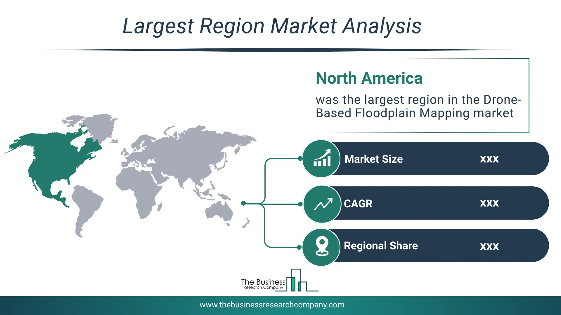
Regional Outlook
North America was the largest region in the drone-based floodplain mapping market in 2025. Asia-Pacific is expected to be the fastest-growing region in the forecast period. The regions covered in this market report are Asia-Pacific, South East Asia, Western Europe, Eastern Europe, North America, South America, Middle East, Africa. The countries covered in this market report are Australia, Brazil, China, France, Germany, India, Indonesia, Japan, Taiwan, Russia, South Korea, UK, USA, Canada, Italy, SpainWhat Defines the Drone-Based Floodplain Mapping Market?
The drone-based floodplain mapping market consists of revenues earned by entities by providing services such as aerial surveying, data collection using drones, topographic mapping, geospatial analysis, and creating digital terrain models for planning and management purposes. The market value includes the value of related goods sold by the service provider or included within the service offering. The drone-based floodplain mapping market also includes sales of mapping software, geographic information system (GIS) tools, 3D photogrammetry software, multispectral and hyperspectral imaging sensors, and data processing and analytics platforms. Values in this market are ‘factory gate’ values, that is, the value of goods sold by the manufacturers or creators of the goods, whether to other entities (including downstream manufacturers, wholesalers, distributors, and retailers) or directly to end customers. The value of goods in this market includes related services sold by the creators of the goods.How is Market Value Defined and Measured?
The market value is defined as the revenues that enterprises gain from the sale of goods and/or services within the specified market and geography through sales, grants, or donations in terms of the currency (in USD unless otherwise specified). The revenues for a specified geography are consumption values that are revenues generated by organizations in the specified geography within the market, irrespective of where they are produced. It does not include revenues from resales along the supply chain, either further along the supply chain or as part of other products.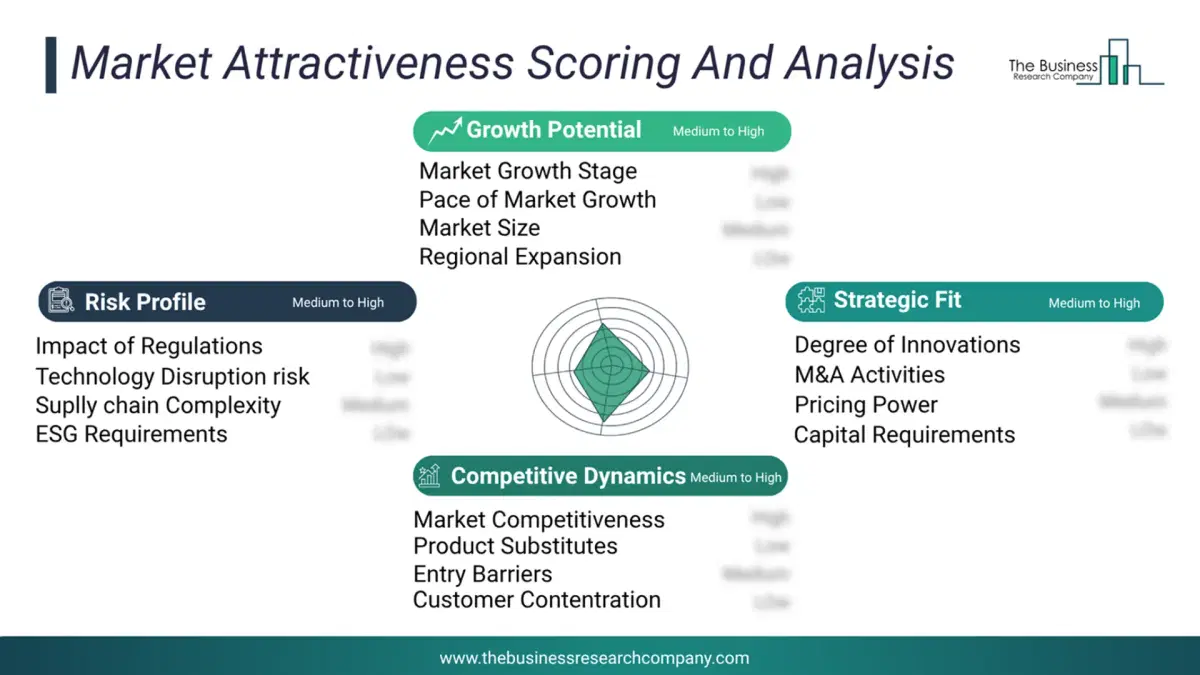
This chart presents market attractiveness based on a quantitative evaluation of growth, competition, strategic alignment, and risk, offering a clear view of opportunity areas for decision-making. This chart is for illustrative purposes; the full report contains the complete analysis.
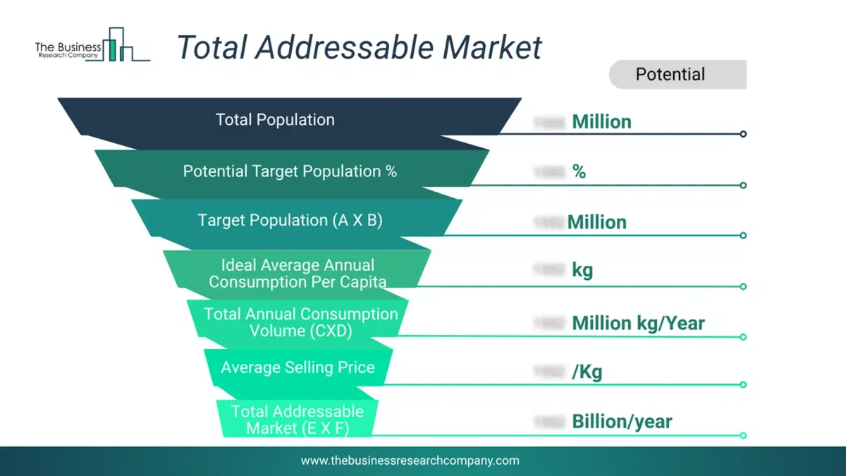
This chart highlights the Total Addressable Market (TAM) by estimating the maximum revenue opportunity using an assumption-driven approach, supporting strategic planning and opportunity sizing across markets. The chart is illustrative; the full report provides a more comprehensive analysis.
What Key Data and Analysis Are Included in the Drone-Based Floodplain Mapping Market Report 2026?
The drone-based floodplain mapping market research report is one of a series of new reports from The Business Research Company that provides market statistics, including industry global market size, regional shares, competitors with the market share, detailed market segments, market trends and opportunities, and any further data you may need to thrive in the drone-based floodplain mapping industry. The market research report delivers a complete perspective of everything you need, with an in-depth analysis of the current and future state of the industry.Drone-Based Floodplain Mapping Market Report Forecast Analysis
| Report Attribute | Details |
|---|---|
| Market Size Value In 2026 | $1.94 billion |
| Revenue Forecast In 2030 | $4.38 billion |
| Growth Rate | CAGR of 22.6% from 2026 to 2030 |
| Base Year For Estimation | 2025 |
| Actual Estimates/Historical Data | 2020-2025 |
| Forecast Period | 2026 - 2030 |
| Market Representation | Revenue in USD Billion and CAGR from 2026 to 2030 |
| Segments Covered | Solution, Platform, Application, End-User |
| Regional Scope | Asia-Pacific, Western Europe, Eastern Europe, North America, South America, Middle East, Africa |
| Country Scope | The countries covered in the report are Australia, Brazil, China, France, Germany, India, Indonesia, Japan, Taiwan, Russia, South Korea, UK, USA, Canada, Italy, Spain |
| Key Companies Profiled | SZ DJI Technology Co. Ltd., Esri Inc., Topcon Positioning Systems Inc., Terra Drone Corporation, Autel Robotics Co. Ltd., Skydio Inc., Quantum-Systems GmbH, Parrot SA, Microdrones GmbH, Pix4D SA, Wingtra AG, Delair SAS, AgEagle Aerial Systems Inc., FlyGuys Inc., GreenValley International LLC, GeoCue Group Inc., Draganfly Inc., Darling Geomatics Inc., Inspired Flight Technologies Inc., IdeaForge Technology Pvt. Ltd. |
| Customization Scope | Request for Customization |
| Pricing And Purchase Options | Explore Purchase Options |